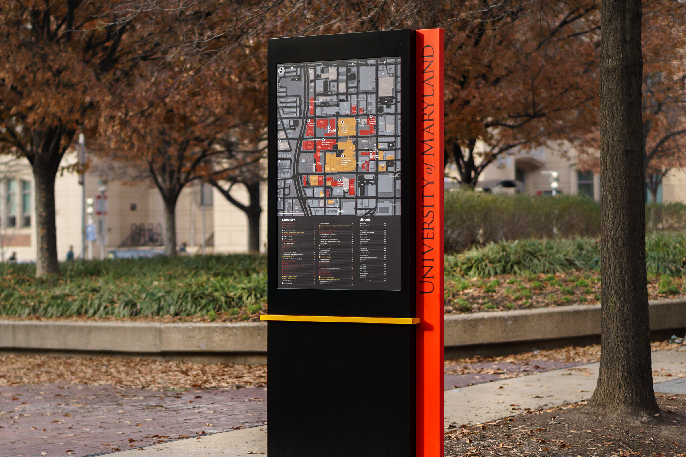
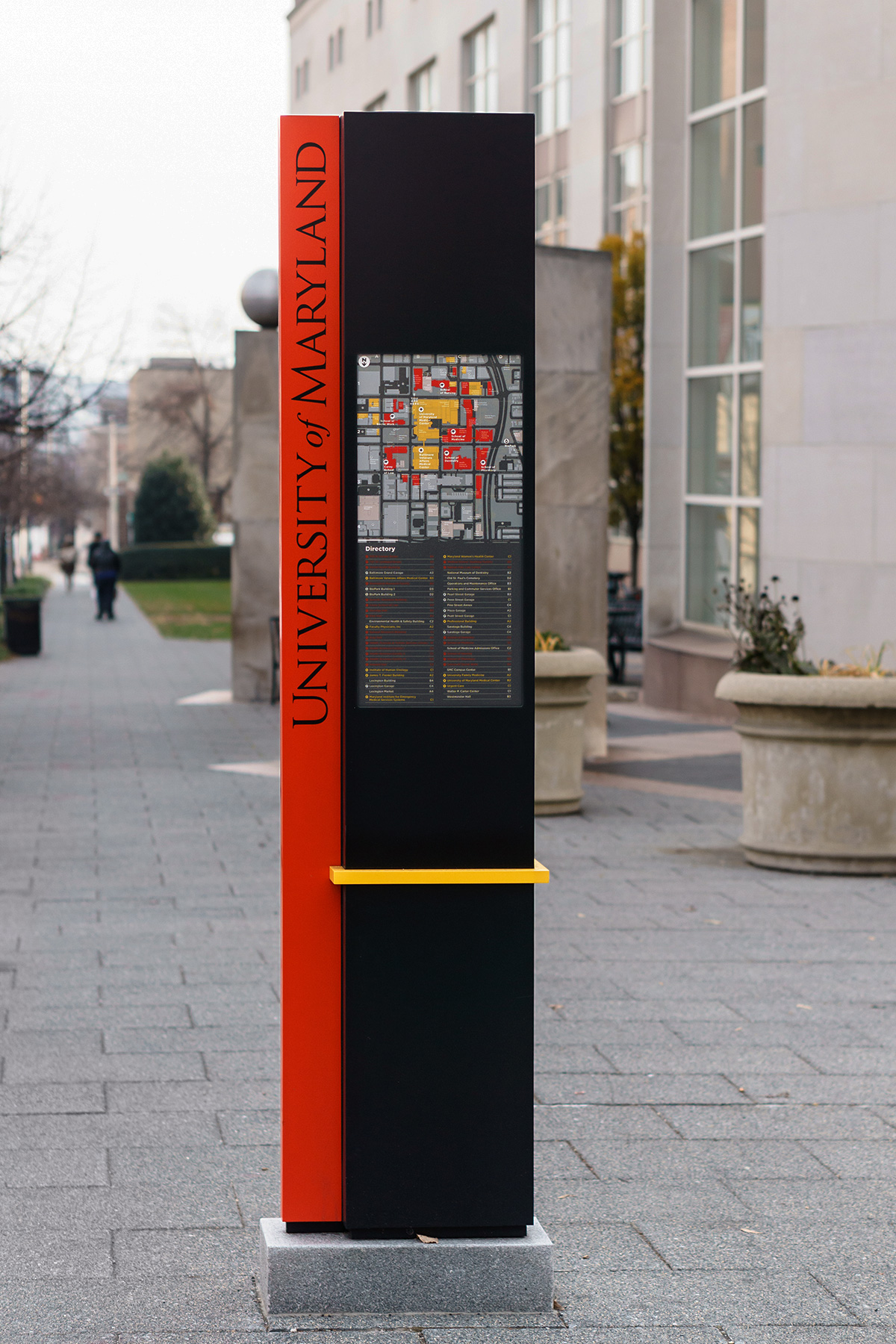
Mapping for The University of Maryland
Custom maps for the new campus wayfinding scheme at The University of Maryland, Baltimore
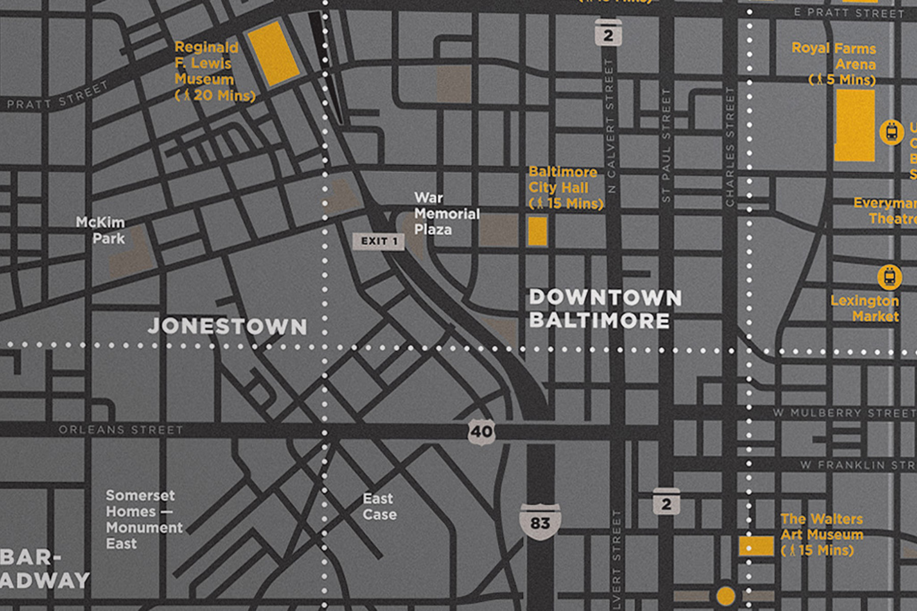
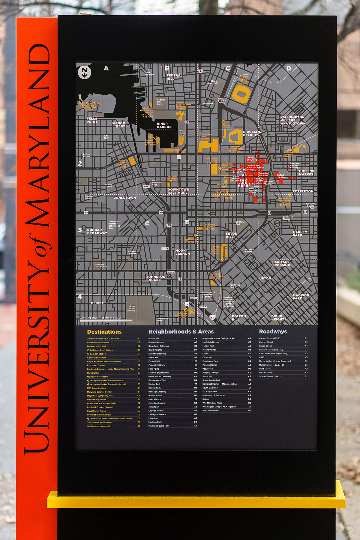
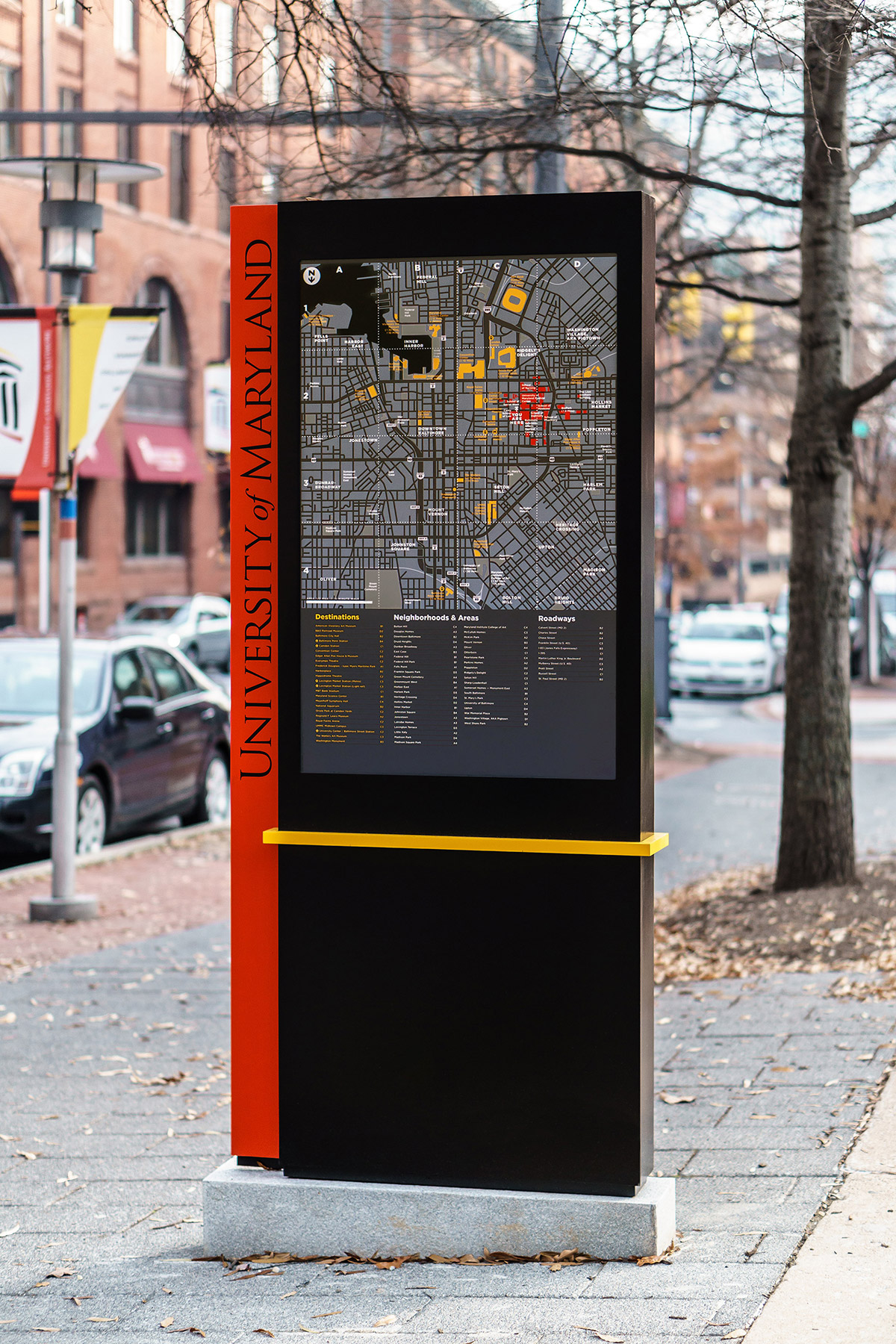
UMB is located on the west side of downtown Baltimore, in one of the most pedestrian-friendly parts of the city, and in walking distance from downtown, City Hall, and Inner Harbor.
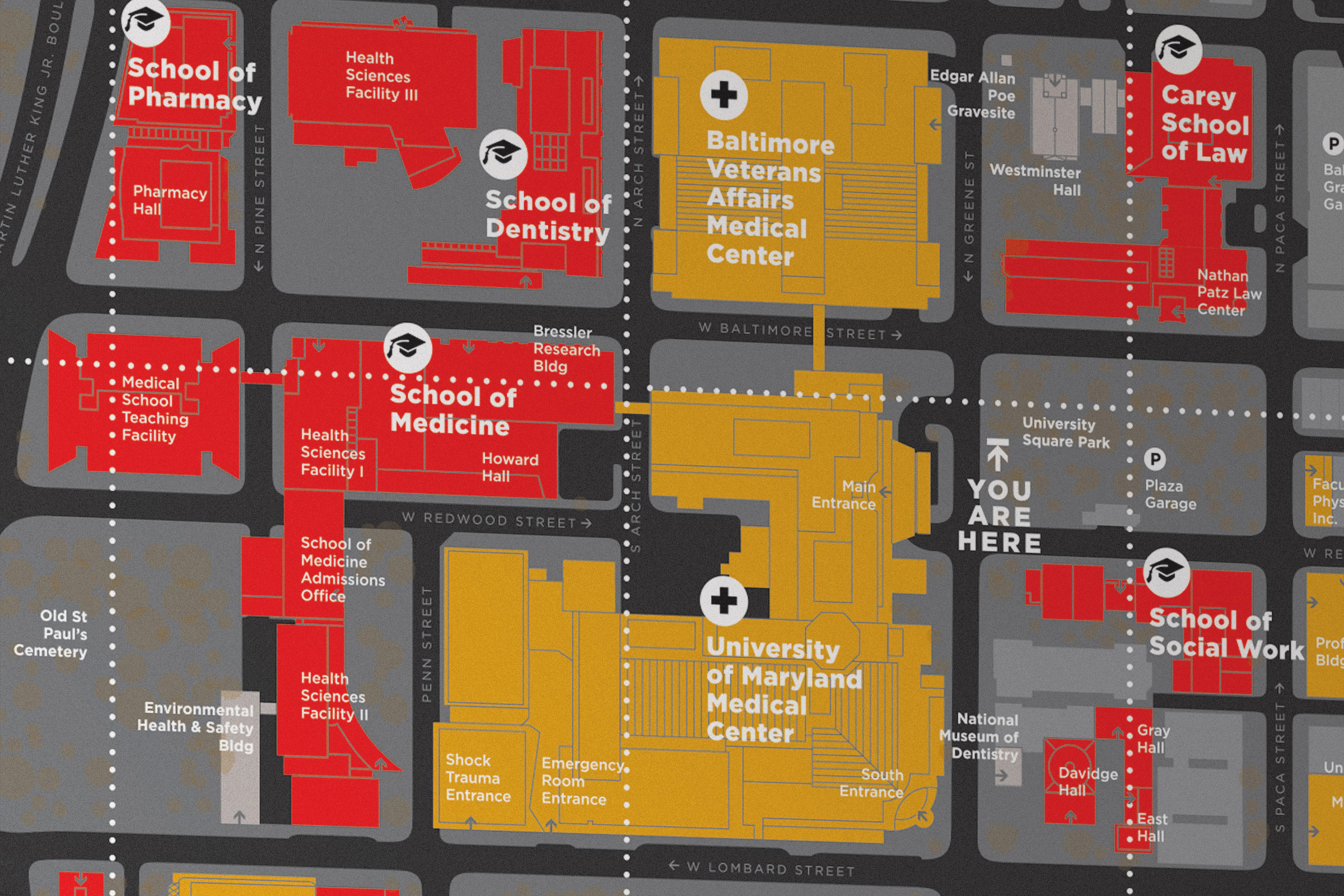
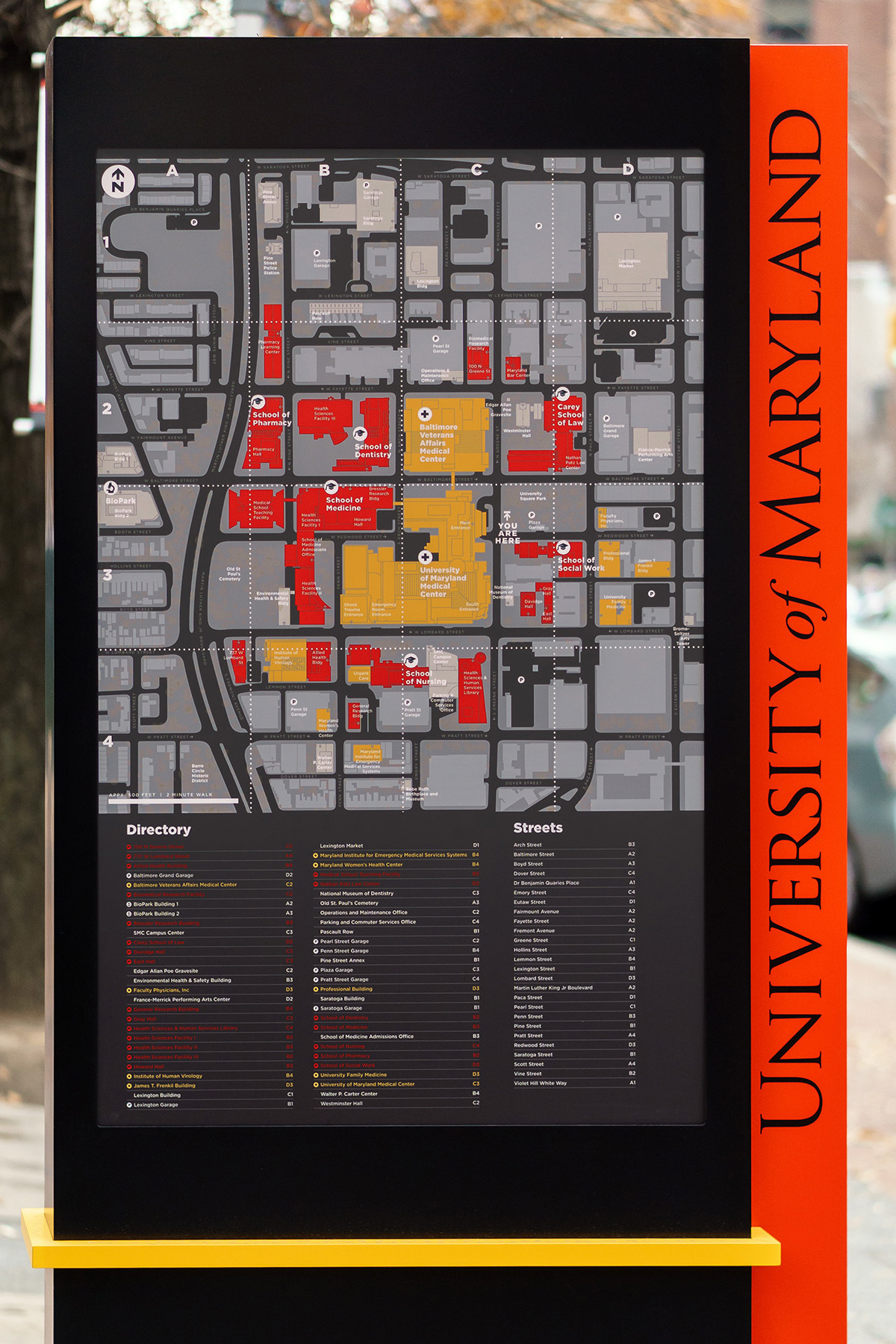
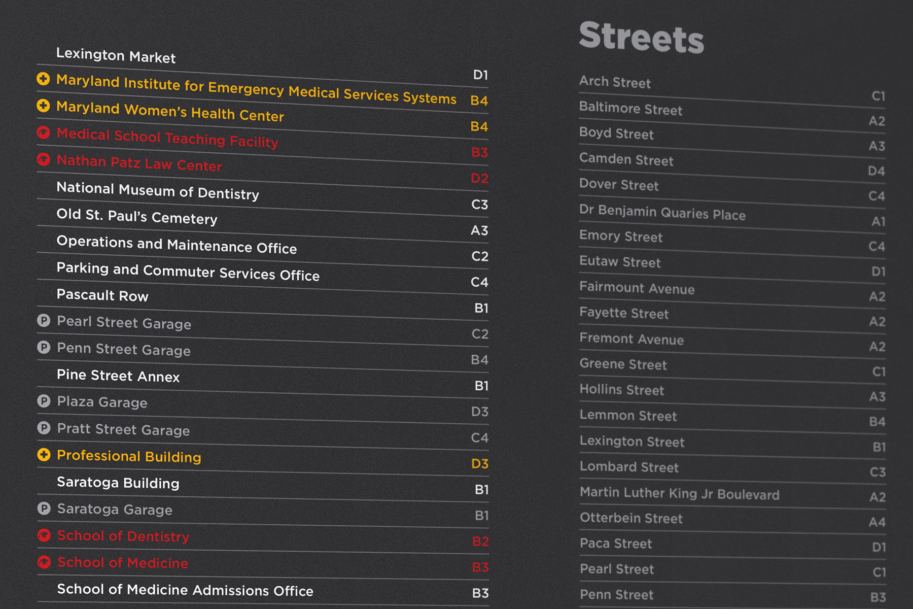
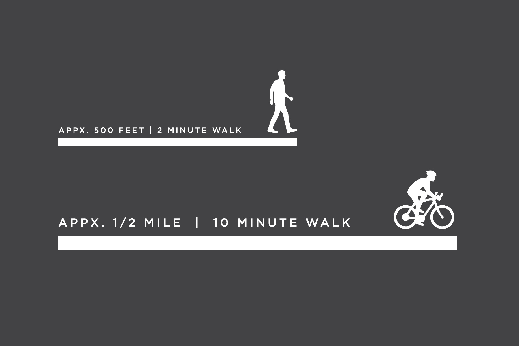
The two types of maps — the campus map, and the area map highlighting points of interest downtown — were developed as fully custom components of the new wayfinding system on campus. Maps encourage walking, cycling, and public transportation use, and improve accessibility of the campus with indicators of building entrances, diagrams of curbs and alleyways, hierarchy of destinations, and an index of streets and buildings.
Role: designer. Designed at C&G Partners
Creative direction: Amy Siegel
Collaborators: Color-Ad (fabricator), SH Immersive Environments (printer). Photography: au2026
Collaborators: Color-Ad (fabricator), SH Immersive Environments (printer). Photography: au2026